

GeoFinderAI ✓
AI-powered location detection from images
Trial; then from $5
Verdict
A quick read before you dig into the full page.
- Best if
- AI-powered location detection from images
- Skip if
- Image size limit
- Pick this when
- High accuracy location detection
Considering GeoEvident instead? Compare side by side
Overview
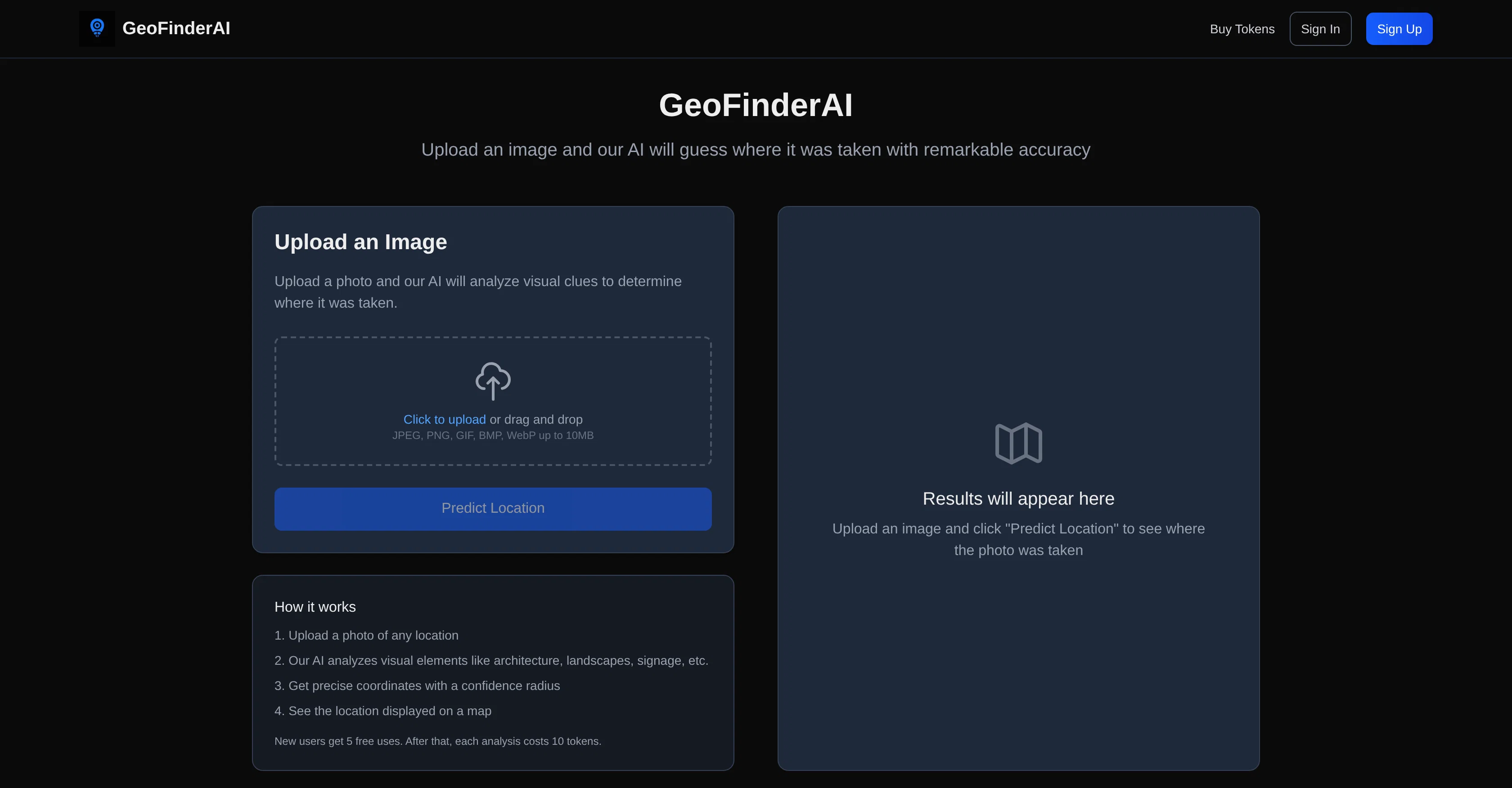
GeoFinderAI is an AI-powered tool designed to detect the geographic location of any uploaded image with high accuracy. The tool accomplishes this task by analyzing various visual elements in the image, such as landscapes, architecture, signage, and more.
It is capable of handling a wide array of image formats, including JPEG, PNG, GIF, BMP, and WebP, with an image size limit of up to 10MB. Once the analysis phase is complete, GeoFinderAI provides not only the estimated geographic coordinates of the location but also a confidence radius, which is represented on a digital map.
This portrays not just the probable location, but also the level of confidence in the prediction. While ideal for identifying and verifying locations from photographic materials, it's important to note that this service operates on a token-based system.
New users receive an initial amount of free uses, after which image analyses will require the purchase and expenditure of tokens. Although the exact number of initial free uses and the cost per analysis may vary, adequate usage guidelines are in place to keep the performance and availability of the tool reliable and efficient.
Featured on platforms like Dang.ai and Startup Fame, GeoFinderAI is continually developing, aiming to improve its accuracy and usability for a diverse range of users.
Best for
Short scenarios where GeoFinderAI tends to shine.
-
AI-powered location detection from images
Example outputs 1
Sample generations and before/after results for GeoFinderAI.
Access & connections
Where you can use GeoFinderAI.
Platforms
Capabilities
What this tool accepts, produces, and is strongest at.
Input
- Image
Output
- Geo
Pros & cons
Pros
- High accuracy location detection
- Analyzes various visual elements
- Supports multiple image formats
- Up to 10MB image size
- Provides estimated geographic coordinates
- Displays confidence radius
- Location represented on map
- Ideal for verifying locations
Show 13 more
- Operates on token-based system
- Initial free uses
- Reliable and efficient
- Continual development
- Featured on notable platforms
- Architecture identification
- Landmark detection
- Digital mapping tool
- Caters for diverse users
- Image-based navigation
- Computer vision tech
- Location analytics
- JPEG, PNG, GIF, BMP, WebP Analysis
Cons
- Token-based system
- Limited free usage
- Image size limit
- No API mentioned
- Confidentiality of uploads unclear
- Possible inaccuracies in prediction
- Non-adjustable confidence radius
- Dependent on image quality
Compare alternatives
Similar tools in the catalog — with a clear reason to open each one.

GeoEvident ✓
UnknownUnmask photo locations with AI geolocation intelligence.
No pricing
Full comparison
Picarta ✓
FreemiumFind where photos were taken using AI.
Why look Offers a public API
Full comparison
GeoInfer ✓
FreemiumLocate where any photo was taken no metadata required
Free + from $58.61/mo
Full comparison
GeoSeer ✓
FreemiumFind photo locations using AI geolocation technology.
Why look Higher community rating
Full comparison
GeoAxis ✓
Free TrialFind where any photo was taken no GPS needed.
Why look Typically cheaper
Full comparison
GeoSolver ✓
FreemiumAI-powered geographic analysis from any image.
Free + from $5.83/mo
Full comparisonPeople also view
Tools that often show up alongside GeoFinderAI in collections and comparisons.
GeoInfer ✓
FreemiumLocate where any photo was taken no metadata required
Picarta ✓
FreemiumFind where photos were taken using AI.
GeoSolver ✓
FreemiumAI-powered geographic analysis from any image.
GeoSeer ✓
FreemiumFind photo locations using AI geolocation technology.
GeoEvident ✓
UnknownUnmask photo locations with AI geolocation intelligence.
GeoAxis ✓
Free TrialFind where any photo was taken no GPS needed.

Mindsmith ✓
FreemiumPlatform for building and sharing eLearning content

Mind Map Wizard ✓
FreemiumGenerate mind maps with AI: free, no sign-up, no ads
Releases 1
Imported reviews 8
I gave it a photo of a city, it only got the country right but not even the city.
Just a wrapper that calls LLM API
I tried a landmark and it didn't even get the country right
Again and again: "Un unexpected error occurred. Please try again."
Wonderful! so intersting! He's right
IT REALLY WORKS! I COULD FIND SOME BACKGROUNDS THAT I REALLY WONDERED WHERE THE PHOTOS WERE TAKEN! TYVM!
This thing is actually insane. I uploaded a picture from a random hike I did years ago, and it guessed the location exactly. Not just the country but the exact trail. I have no idea how it works, but its pretty impressive.
Very poor tool.
I tried 4 pics.
2 quite hard
1 medium hard (it fell into the trap because it is trained on mainstream pictures, he did not analyze the full environment)
1 easy (like eiffel tower)
the tool only found the eiffel tower.
If I need a tool like that it is for hard pics, not for easy pics.
Better ask geoguessr experts then.
no dedicated field to explain where the picture has been taken in order to help training the tool.
FAQ 12
What is GeoFinderAI?
How does GeoFinderAI work?
What image formats can GeoFinderAI analyze?
What is the maximum image size that GeoFinderAI can handle?
What does GeoFinderAI provide after analyzing an image?
What is the 'confidence radius' that GeoFinderAI offers?
How does GeoFinderAI represent the predicted location?
Why does GeoFinderAI operate on a token-based system?
What are the benefits of GeoFinderAI's token-based system?
How many free usages does GeoFinderAI offer to new users?
How much does each image analysis cost in GeoFinderAI?
What platforms has GeoFinderAI been featured on?
Related tools
Recommended

Automateed ✓
Free TrialCreate eBooks effortlessly with Automateed, the AI-powered writing tool.

freebeat AI ✓
FreemiumTurn Music & Ideas into Viral Videos In One Click

DeepSeek ✓
FreeUnravel the mystery of AGI with curiosity

remio: Your Personal ChatGPT ✓
FreemiumGet Tailored Answer with Your Personal ChatGPT

ChatGPT ✓
FreemiumAsk anything, create anything, and move from idea to action.

TheLibrarian.io ✓
Free TrialYour WhatsApp AI assistant for instant productivity.