

Image geolocation 2026 Rank: #789
GeoEvident ✓
Unmask photo locations with AI geolocation intelligence.
Verdict
A quick read before you dig into the full page.
- Best if
- Unmask photo locations with AI geolocation intelligence
- Skip if
- Limited to specific sectors
- Pick this when
- Designed for investigation teams
Considering Picarta instead? Compare side by side
Overview
GeoEvident is an AI-powered Geolocation Intelligence Platform designed primarily for investigative teams in government and enterprise sectors including law enforcement, border control, insurance, corporate security and compliance.
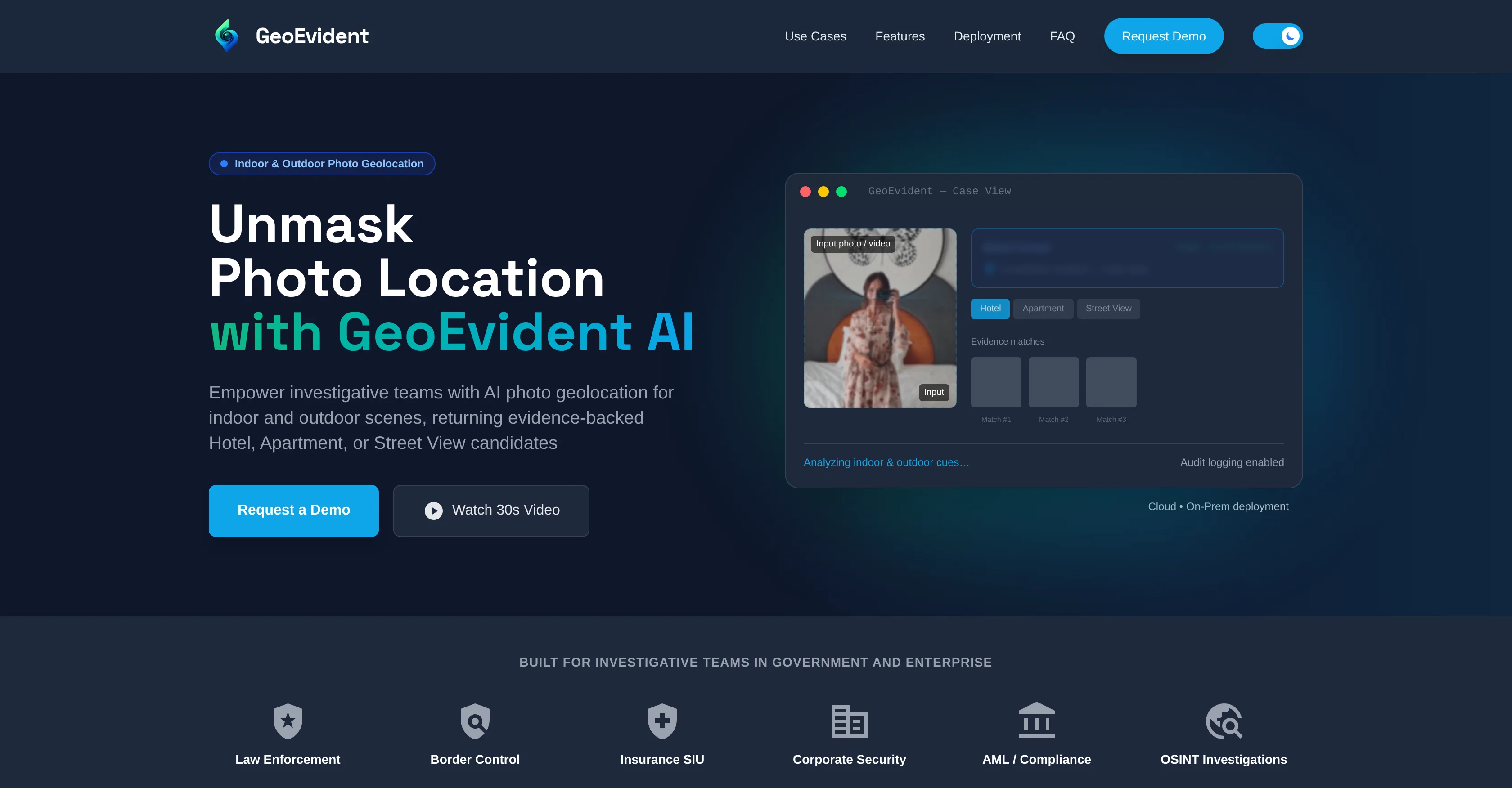
The platform provides both indoor and outdoor photo geolocation capability, which aids in the investigation process by surfacing likely location matches based on visual cues in images or videos.
These matches could be from varied contexts such as a hotel, apartment or street view. The platform employs a high confidence matching system that identifies and validates locations by analyzing distinctive details like interior layouts, furnishings, architectural features and urban details in images.
It also allows for identification of specific hotel properties from interior photos, street-level and outdoor geolocation like matching streetscapes and architecture, and verification of images or videos to support story verification and fact-checking.
GeoEvident equips users with ranked candidates of location matches, all supported with visual similarities that can be documented and compared. Users can generate a structured case report comprising key findings, audit logs and an exportable record of results for review.
One of the platforms distinguishing features includes options for secure and adaptable deployment. Organizations can choose between cloud-based deployments with configurable data residency and retention options, or on-premise and air-gapped deployment for enhanced data control which supports containerization delivery.
GeoEvident also takes into cognizance the handling of sensitive data - access control is maintained via Role-Based Access Control (RBAC), and operations can be recorded through audit logs for oversight and transparency purposes.
Best for
Short scenarios where GeoEvident tends to shine.
-
Unmask photo locations with AI geolocation intelligence.
Example outputs 1
Sample generations and before/after results for GeoEvident.
Access & connections
Where you can use GeoEvident.
Platforms
Capabilities
What this tool accepts, produces, and is strongest at.
Input
- Image
Output
- Geo
- Tabular
- Image
Highlights
- Local
Supported features
- Image Understanding
- Video Understanding
- Runs Locally
- Automation
Pros & cons
Pros
- Designed for investigation teams
- Indoor and outdoor image analysis
- Visual cue-based location matches
- Adaptable to varied applications
- Supports OSINT investigations
- AML and compliance due diligence
- Provides verifiable location matches
- Supports image and video analysis
Show 17 more
- Can verify rental listing images
- Secure cloud or on-premise deployments
- RBAC for access control
- Maintains audit logs
- Generates structured case reports
- High confidence matching system
- Analyzes interior layouts, furnishings
- Identifies hotel properties from photos
- Supports story verification and fact-checking
- Ranked candidates of location matches
- Exportable record of results
- Flexible deployment options
- Supports air-gapped deployment
- Containerization delivery support
- Data retention options
- Locates image or video capture locations
- Customizable data residency options
Cons
- Requires distinctive visual cues
- Inconsistent accuracy
- No real-time tracking
- Cloud deployment risks
- Limited indoor geolocation
- Depends on photo quality
- Can't geolocate social media
- Limited to specific sectors
Show 2 more
- Possibly slow analysis time
- Requires secure environments
Compare alternatives
Similar tools in the catalog — with a clear reason to open each one.

GeoInfer ✓
FreemiumLocate where any photo was taken no metadata required
Free + from $58.61/mo
Full comparison
GeoSeer ✓
FreemiumFind photo locations using AI geolocation technology.
Why look Higher community rating
Full comparison
GeoAxis ✓
Free TrialFind where any photo was taken no GPS needed.
Free + from $0.90
Full comparison
GeoSolver ✓
FreemiumAI-powered geographic analysis from any image.
Free + from $5.83/mo
Full comparisonPeople also view
Tools that often show up alongside GeoEvident in collections and comparisons.
GeoInfer ✓
FreemiumLocate where any photo was taken no metadata required

Picarta ✓
FreemiumFind where photos were taken using AI.
GeoSolver ✓
FreemiumAI-powered geographic analysis from any image.
GeoSeer ✓
FreemiumFind photo locations using AI geolocation technology.

GeoFinderAI ✓
Free TrialAI-powered location detection from images
GeoAxis ✓
Free TrialFind where any photo was taken no GPS needed.

Denovo ✓
FreemiumTurn your idea into a real business in minutes.

Claude ✓
FreemiumBuilding reliable, interpretable AI systems
Releases 1
Imported reviews 1
UI looks impressive, but accuracy is not as advertised
FAQ 12
How does GeoEvident analyze photos for geolocation?
What kind of investigations does GeoEvident support?
Can GeoEvident identify indoor locations from photos?
How does GeoEvident verify location candidates?
Can GeoEvident be used for source validation of images and videos?
What roles does RBAC facilitate in GeoEvident?
How does GeoEvident's AI aid in insurance claim verification?
Can GeoEvident be deployed on cloud and on-premises networks?
How are sensitive investigations handled in GeoEvident?
How does GeoEvident support AML compliance and due diligence?
What information is included in GeoEvident case reports?
Can GeoEvident authenticate apartment or rental listing images?
Related tools
Recommended
Denovo ✓
FreemiumTurn your idea into a real business in minutes.

Uramaki ✓
Free TrialGenerate social media content from a single prompt in seconds.

TitleGen ✓
Free TrialGenerate high-CTR YouTube titles in seconds.

RoomStaging ✓
PaidTransform empty properties into beautiful homes in seconds.
Claude ✓
FreemiumBuilding reliable, interpretable AI systems

MarketAlerts.ai ✓
FreemiumInvest smarter with AI on your side