

LocaleScan ✓
Empower real estate decisions with area insights
Verdict
A quick read before you dig into the full page.
- Best if
- Empower real estate decisions with area insights
- Skip if
- Limited scan radius
- Pick this when
- Interactive map interface
Considering Ace AI instead? Compare side by side
Overview
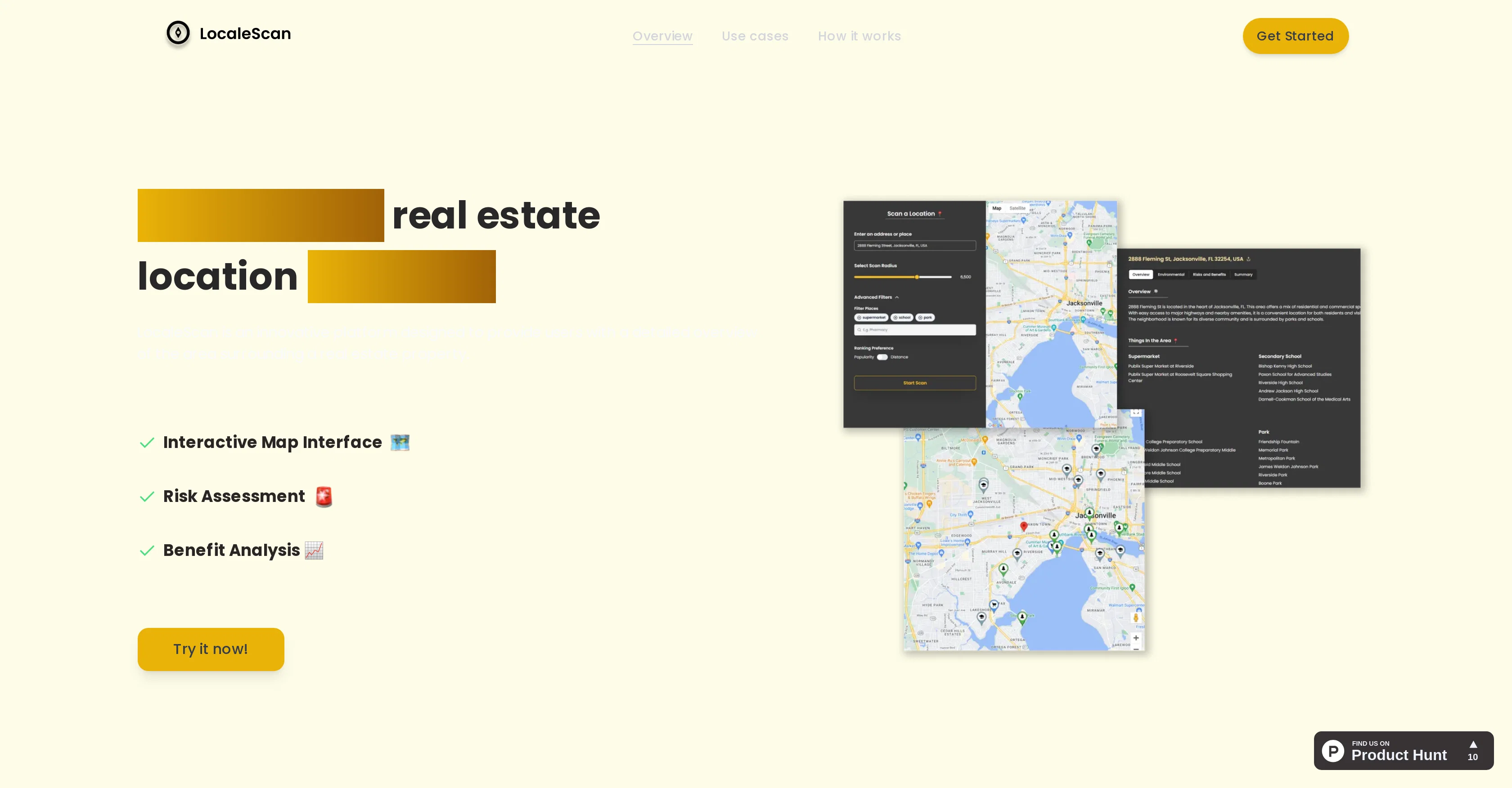
LocaleScan is an innovative platform equipped with advanced AI and mapping tools, created to offer a comprehensive overview of any real estate area. Its interactive map interface allows users to explore different layers of information about the area surrounding a property.
These layers include distinct markers representing different types of places such as schools, hospitals, and recreational amenities. The platform also provides a risk assessment for every area, giving the user an understanding of crime rates, environmental hazards and the economic stability of the neighborhood.
Moreover, it offers a benefit analysis which displays local amenities, quality educational institutions and childcare facilities to aid in assessing lifestyle options and educational opportunities.
LocaleScan finds applications among home buyers, renters, real estate investors, agents, urban planners and developers. Users can specify a location to analyze, define a scan radius and subsequently, the platform will generate comprehensive results.
This platform is created with a mission to provide data-driven insights and aid informed real estate decisions.
Access & connections
Where you can use LocaleScan.
Platforms
Capabilities
What this tool accepts, produces, and is strongest at.
Input
- Geo
Output
- Geo
Pros & cons
Pros
- Interactive map interface
- Multiple information layers
- Distinct location markers
- Risk assessment feature
- Crime rate analysis
- Environmental hazard assessment
- Economic stability evaluation
- Benefit analysis provision
Show 29 more
- Local amenities display
- Educational institutions data
- Childcare facilities information
- Customizable scan radius
- Comprehensive result generation
- Detailed overview provision
- Informed decision making support
- Data-driven insights
- Noise and pollution level details
- Proximity to highway info
- Industrial sites proximity
- Local restaurants, bars display
- Shopping centers, gyms info
- Entertainment venues and supermarkets info
- Grocery stores data
- Public and private school list
- Colleges, daycare centers data
- Applications for home buyers
- Applications for renters
- Tools for real estate investors
- Support for real estate agents
- Useful for urban planners
- Beneficial for developers
- Step-by-step operation
- Evaluation of area's economic health
- Up-to-date crime statistics
- Location specification feature
- Ability to identify high-potential investment areas
- Helps avoid areas with significant risks
Cons
- No offline functionality
- No API for integration
- Potential data privacy issues
- Lacks historical data comparison
- Limited scan radius
- No mobile application
- Relies heavily on user input
- Data accuracy not verified
Show 2 more
- Requires constant internet connection
- No multi-language support
Compare alternatives
Similar tools in the catalog — with a clear reason to open each one.

Ace AI ✓
FreemiumThe AI that works your Follow Up Boss leads with you
Free + from $25.00/mo
Full comparison
Intuo – Your AI geospatial analyst ✓
FreeAsk a question about anywhere. Get analyst-grade maps and answers.
Why look Offers a public API
Full comparison

NestTrack ✓
Free TrialScreenshot any listing, AI fills the details.
Free + from $9/mo
Full comparison
Mira AI Systems ✓
PaidFair Housing-compliant AI tools for real estate professionals.
Why look Better for writing
Full comparison
Releases 1
Imported reviews 1
tested it on a few neighborhoods. the interface is so stripped down it almost feels unfinished, quick to load but u might hunt for extra fillers. the data look on point, yet they dont dive deep into data sources to explain. overall accuracy feeks solid and the map is smooth, just wish it talked more about the results.
FAQ 12
What is LocaleScan?
What exactly can LocaleScan be used for?
Who would find LocaleScan most useful?
How does LocaleScan analyze a location?
Can I define the scan radius on LocaleScan?
What type of information can I find on LocaleScan's interactive map?
How does LocaleScan assess the risks of a certain area?
Does LocaleScan provide details about crime rates and environmental hazards?
Does LocaleScan offer benefit analysis?
What does the benefit analysis include on LocaleScan?
Can LocaleScan analyze educational opportunities at a chosen location?
Can LocaleScan assist with real estate investing decisions?
Related tools
Recommended

BetterDeal AI ✓
FreemiumFind hidden gem properties for real estate investing.

FetchFox ✓
FreemiumScrape any data from any website, with AI

ARCHITEChTURES ✓
FreemiumAI-powered design: Months to minutes for buildings.

JudeAI ✓
PaidAI assistant for real estate pros

Specifys.ai ✓
FreemiumPlan your dream app with smart AI tools

Leadflow ✓
Free TrialAI-powered lead generator for real estate investors.